Newsletter No. 21
August 10, 2022
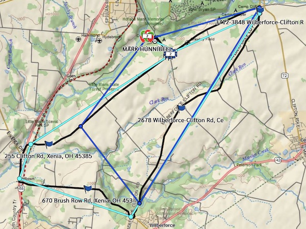
Yesterday, the day finally arrived! I mapped out a local route of some 13.5 miles with mostly right hand turns, no traffic lights, and only a couple stop signs. After firing up the Red One for the first time in too long (started on the first crank!), I geared up and headed out. I had navigation and tracking equipment on board and the image below is what was “tracked” by satellite. The aquamarine line is the line between the points reported by satellite (supposedly every 10 minutes), but in this map you can see the actual route we took (not sure if that will always be displayed). I don’t know what the dark blue line is. This is the kind of map that anyone will be able to see, live, during the ride in September.
Besides navigation gear, this was a trial by fire for both intercom and camera. I had video camera on the left side of my helmet that also recorded the intercom chatter between me, Glen (out front), and Willie (behind me). The ride took a little less than 30 minutes, but this video shows the “greatest hits” and was an excellent “proof of concept” that we’ll only improve upon in the next few weeks. Next ride is in two days, on Friday, but boy do I have a “punch list” of things to work on before then!
Enjoy!
Mark


